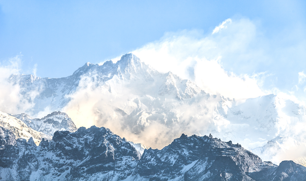
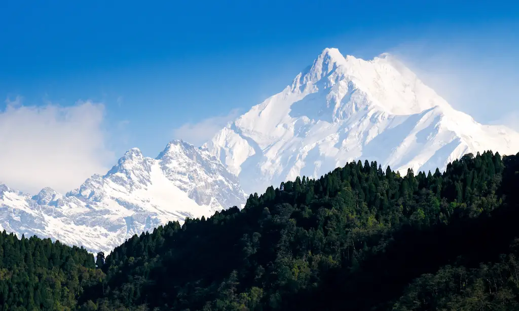
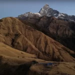
The third-highest mountain summit on the planet is named Mount Kangchenjunga Main. It is located in a region of the Himalayas known as the Kangchenjunga mountain range, which is bounded to the west and north by the Tamur River and the Nepal-China boundary, respectively, and stands 8,586 m (28,169 ft) above sea level.
In the Taplejung district, Kangchenjunga lies on the boundary of the rural municipalities of Phaktanglung and Sirijanga. Kangchenjunga Main is located 0.8 km to the northwest of Kangchenjunga Central and 1.1 km to the east-southeast of Yalung Khang.
A Bit of History
Prior to 1852, it was believed that Kangchenjunga main was the highest summit on planet Earth, but in 1849 measurements done by the Great Trigonometrical Survey of India led to the discovery that Mount Everest was really the highest peak. At the time Mt. Everest was known as Peak XV.
It was formally declared that Kangchenjunga was the third-highest highest point on the planet in 1856, enabling additional confirmation of all estimates. On May 25, 1955, Joe Brown and George Band, two members of a British expedition, completed the first successful ascent of Kangchenjunga.
However, after promising the Chogyal that the mountain’s summit would stay untouched, they came to a stop just short of the top. This custom has been followed by each summit-climbing individual or group.
The Naming
The Royal Geographical Society, Alexander Mitchell Kellas, and Douglas Freshfield, all selected the word Kangchenjunga as their official spelling since it better captures the Tibetan dialect. The spelling adopted by the Indian government from the late nineteenth century was referred to as “fresh field.” Kangchenjunga, Khangchendzonga, and Kangchendzönga are further spellings.
The local name Kanchinjnga, which means “The five treasures of the high snow,” according to the Schlagintweit brothers, derives from the Tibetan words “gangs,” which means snow or ice, “chen,” which means “big,” “mzod,” which means treasure, and “lnga,” which means five.
When the world is in danger, the treasures—which include salt, turquoise, and other valuable stones, sacred texts, unbreakable armor or ammunition, gold, grain, and medicine—reveal themselves to the pious, according to local Lhopo people.
Physical Characteristics
The massif’s primary ridge, which creates a watershed for multiple rivers, extends from north-northeast to south-southwest. Combined, they create a huge cross with ridges that generally go from east to west. There are several summits between 6,000 and 8,586 meters along these ranges (19,685 and 28,169 ft).
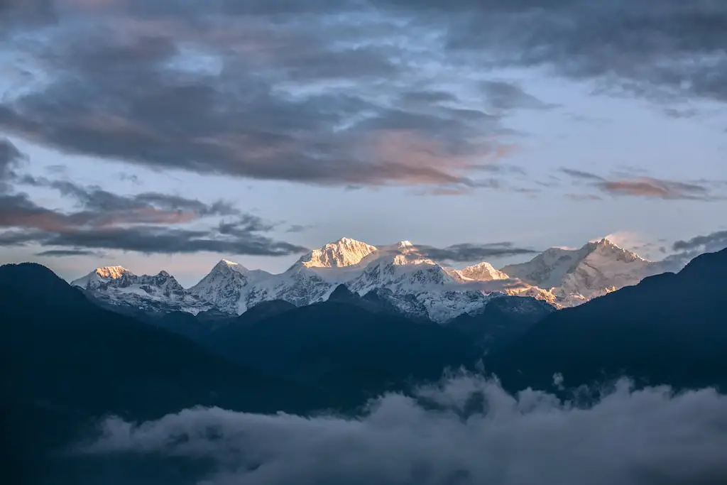
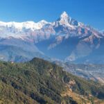
The northern portion, which extends up to the Jongsang La, comprises Yalung Kang, Kangchenjunga Central and South, Kangbachen, Kirat Chuli, and Gimmigela Chuli. Siniolchu is a mountain located on Sikkim’s eastern slope. Kabru I through III are located in the southern part, which is near the Nepal-Sikkim border. The Singalila Ridge is located south of this ridge. The Kumbhakarna, often referred to as Jannu, is the highest point on the western ridge.
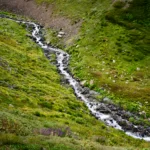
From the top, four major glaciers branch out and generally point in the directions of southeast, southwest, northwest, and northeast. While the Kangchen glacier in the northwest drain and the Yalung glacier in the southwest to the Kosi and Arun rivers, the Talung glacier in the southeast and the Zemu glacier in the northeast do so to the Teesta River.
The glacierized area totals around 121 square kilometers of land, with the glaciers covering the region above roughly 5,000 m (16,000 ft). The Kangchenjunga Himal has 120 glaciers, 17 of which are buried with debris. Moreover, half of the 57 glaciers that were evaluated between 1958 and 1992 had receded, presumably as a result of an increase in air temperature.
The Brahmaputra River basin, one of the biggest in the world and a component of the southeast Asian rainfall system, has its peak altitude at Kangchenjunga Main. Among the six peaks exceeding 8,000 meters (26,000 feet) in the Koshi River basin, one of the biggest sources of the Ganges is Kangchenjunga. Additionally, the Ganges Basin includes the Kangchenjunga mountain.
Despite being the third-highest point on the planet, Kangchenjunga is only the 29th-highest peak by topographic significance, which assesses a mountain’s independence. At an altitude of 4,664 meters (15,302 feet), the crucial col for Kangchenjunga is located in Tibet at the watershed line between the Brahmaputra and the Arun rivers.
Kangchenjunga Conservation Area
The third-highest peak in the world and the second-highest mountain in Nepal, Mt. Kangchenjunga (8,586 meters), is the inspiration for the name of the Kangchenjunga Conservation Area. In March 1998, Kangchenjunga received the designation of a conservation area. It is located in Nepal’s northeastern Taplejung district and spans an area of 2035 square kilometers.
11 peaks in the Taplejung area are higher than 7,000 meters, and there are also glaciers there. With Sikkim, India, to the east and Tibet Autonomous Region (TAR), and China, to the north, the conservation area with distinctive mountain ecosystems is intended to be a tri-national peace park.
Khangchenzonga National Park already exists in Sikkim and borders KCA, but work is now being done on the Chinese side to expand Qomolungma Nature Reserve in TAR to include the area.

Leave a Reply